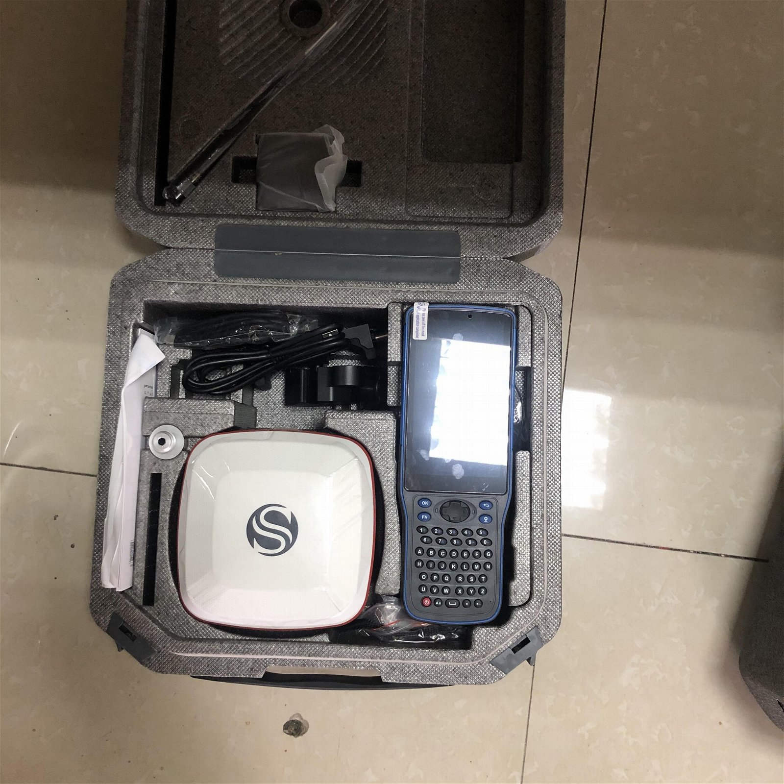
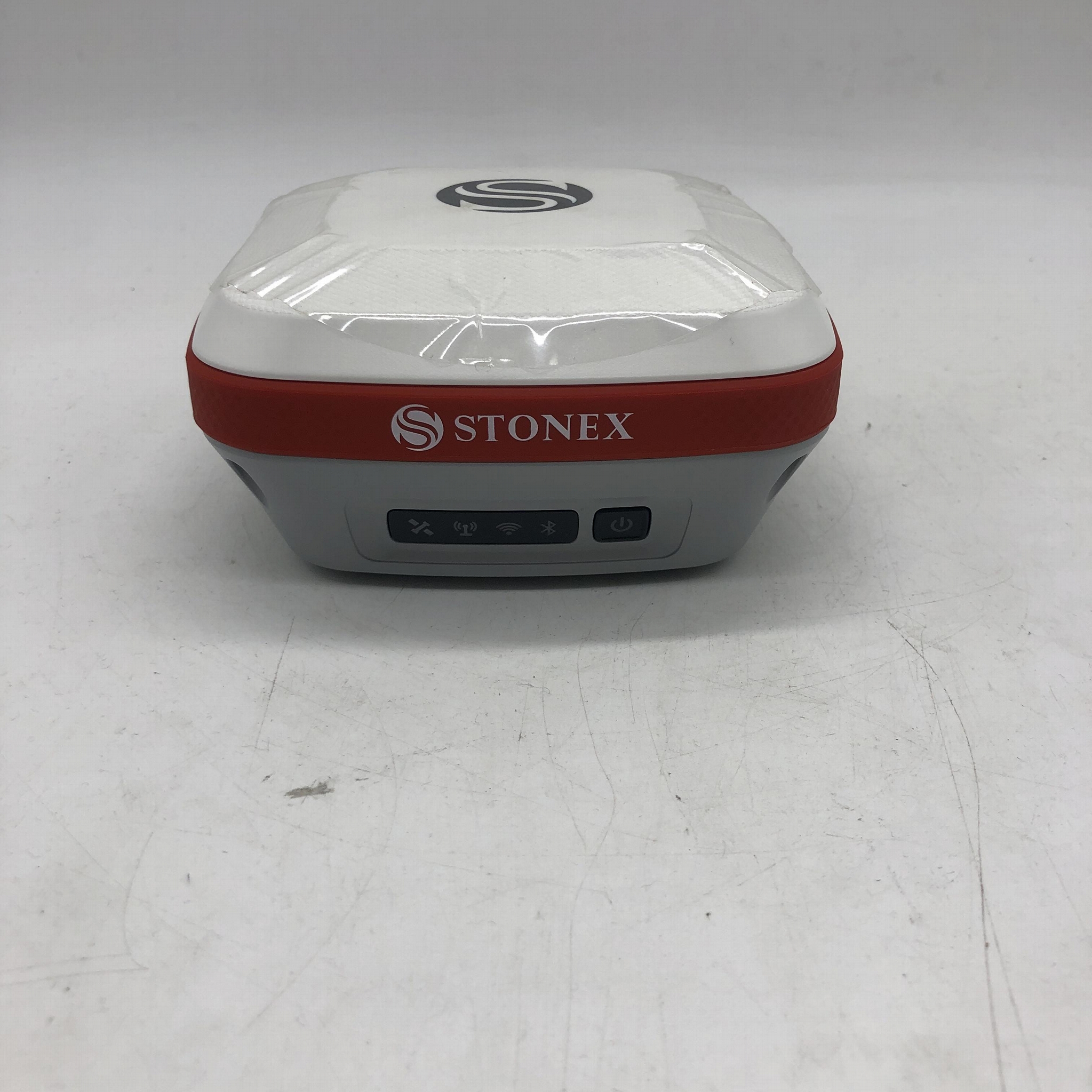
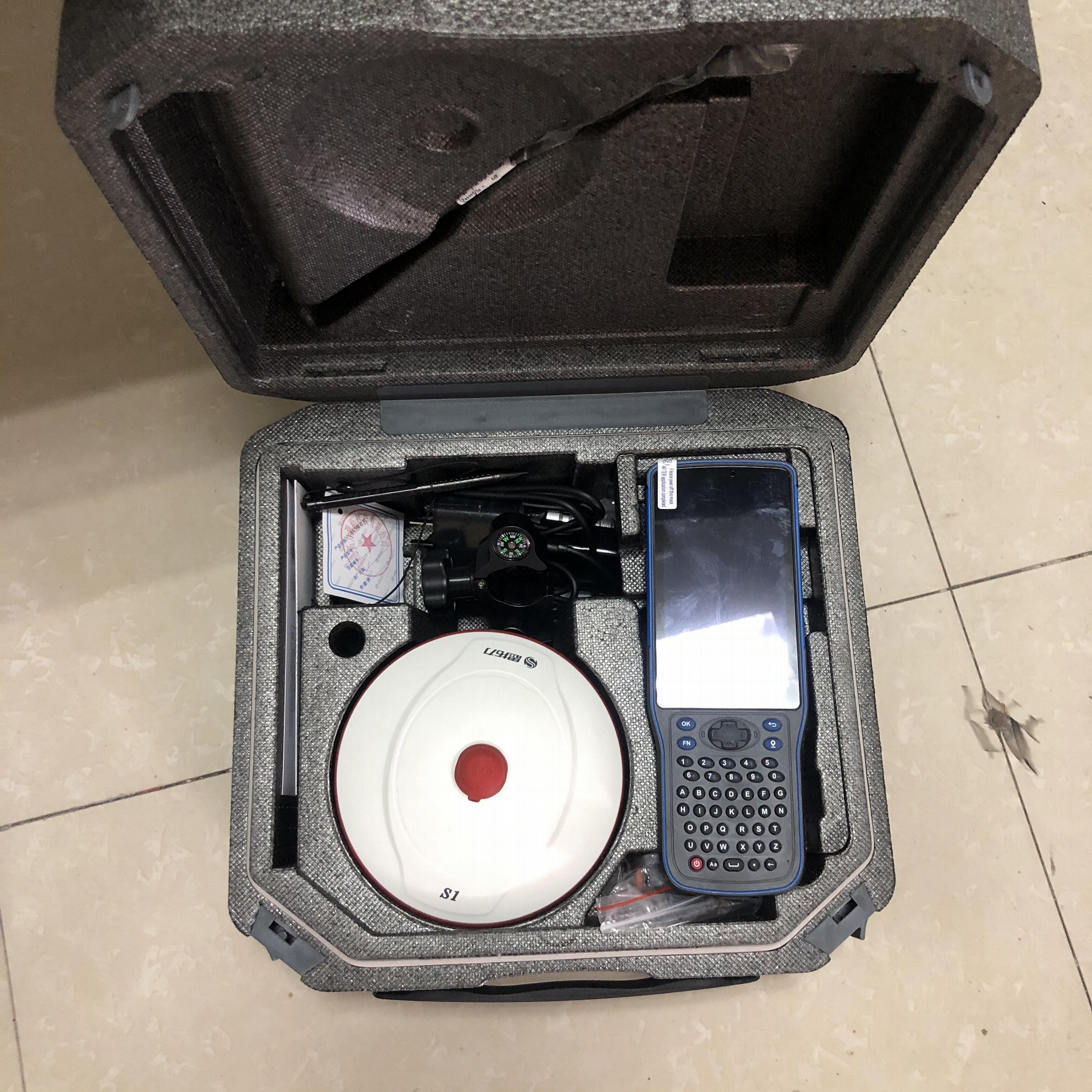
Dual Frequency Stonex GNSS Rover Receiver 800 Channels GPS RTK Stonex S3IISE

Model No.︰S3II SE
Brand Name︰Stonex
Country of Origin︰China
Unit Price︰US $ 3800 / set
Minimum Order︰1 set
Product Description
Product Description
Dual Frequency GNSS rover receiver 800 channels GPS RTK Stonex S3IISE
S3 II SE intelligent RTK is pre-installed with the currently popular inertial navigation tilt measurement technology, allowing
measurement users to keep up with the technological trend and significantly improve the engineering lofting efficiency; Full-size
high-precision positioning Board ensures the signal acceptance quality, fully support Beidou No. 3; IP68 protection level can
withstand the wind, sun and rain on the construction site, and can be used for a longer time. SurPAD 4.0 Professional measurement
software closely adheres to users' needs and provides a variety of lofting tools to easily handle common scenarios involved in
engineering measurement.
1.Process measurement and efficiency assurance
S3II SE intelligent RTK is a powerful tool for engineering measurement, with comprehensive functions, stable performance and
reliable quality. There is also SurPAD4.0, a professional measurement software created by Duoxiao, which can meet the use
requirements of various lofting operations, such as road construction, power line survey, site leveling control, CAD application,
railway lofting, etc.
2.Inertial navigation tilt measurement
Fourth generation inertial navigation tilt measurement
Tilt angle 60 °, accuracy 2cm
It is not subject to electromagnetic interference and does not need bubble centering. It is measured immediately by carrying the
rod, and the working efficiency is improved by 50%.
Ditch River survey area, shelter, easy test;
Building dense area, room corner, easy testing;
Municipal area measurement, easy measurement without winding;
Topographic mapping, easy to measure without looking at bubbles.
3.Hard core technology · full technology
Search star
Based on the second generation of "Tianqin" full-scale high-precision board card, the future-oriented star-ground fusion
high-precision positioning technology, the number of 800 channels, the full-scale holding the North-third, the full-constellation
full-frequency point signal tracking, quickly lock satellite signals.
Letter number
Built-in "Swan" anti-interference technology actively detects and effectively restrains internal and external interference signals
to meet the measurement requirements of complex environments and efficiently fixes the solution.
Continued flight
Built-in dual smart lithium batteries to meet the needs of 10-hour daily work. Type-C interface supports PD fast charging to
shorten charging time. Power Bank is used to supply power when power is in a hurry, ensuring power consumption and worry-free
battery life.
Electric table
Second generation universal radio station, transceiver body, 410-470MHz full frequency. Channel detection actively identifies
interference; 7+2400 channels are set as needed to avoid serial frequency. Truly realize full intercommunication and full
compatibility with mainstream brand RTK radio protocols.
Protection
IP68 military-grade protection against dust invasion to avoid component damage; Even if it is immersed in water for a long time,
it can provide comprehensive protection.
4.P9 Ⅲ full keyboard strong Android book
P9III is a new full keyboard strong Android hand book for professional surveying and mapping users launched by situoli. On the
basis of summarizing the use experience of previous hand books, the overall design is more ergonomic, at the same time, the
operating system, hardware configuration, and software optimization can improve the performance of the Hand Book, easily load
large data, and improve the user experience.
Technical parameter
|
System Configuration |
Environmental Performance |
||
|
Operating system |
Linux |
Operating temperature |
-30℃ ~ +65℃ |
|
Built-in storage |
8GB, supports MicroSD storage expansion |
Storage Temperature |
-40℃ ~ +80℃ |
|
Bluetooth |
V2.1 + EDR/V4.0 dual-mode, CIass2 |
Waterproof and dustproof |
IP68
|
|
WIFI |
802.11b/g/n |
UHF radio station |
Built-in receiving station
|
|
Voice |
TTS voice broadcast |
Operating frequency: |
410-470mhz |
|
Electron bubble |
Support |
|
|
|
Satellite Characteristics |
|||
|
Satellite Channel |
800 |
GLONASS |
G1P1,G2P2,G1OC,G2OC,G3OC |
|
BDS-2 |
B1i,B2i,B3i |
Galileo |
E1BC,E5a,E5b,E5ALTBOC,E6BC |
|
BDS-3 |
B1C,B2a,B2b,ACEBOC |
QZSS |
L1CA,L2C,L5,L1C,LEX |
|
GPS |
L1C/A,L1C,L1P(Y),L2C,L2P(Y),L5 |
L-Band |
Support |
|
Inertial navigation IMU |
|||
|
Tilt measurement |
Supported |
Tilt accuracy |
60 °/2cm (horizontal) |
|
Power supply characteristics |
Physical indicators |
||
|
Battery capacity |
Built-in lithium battery, 7.2v/5200mAh |
Weight |
920g |
|
External Power Supply |
9-28VDC with overvoltage protection |
Size |
Φ152mmx 92mm |


Product Image